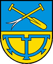
Portrait
Mühlehorn includes the village of the same name, which lies on the southern shore of Lake Walen, as well as the hamlets Vortobel, Tiefenwinkel and Mühletal on the northeastern border of Canton Glarus.
Mühlehorn was mentioned as Mülihorn in 1551 for the first time in a document and only came into possession of Glarus at the beginning of the 15th century. It belonged until 1806 to Obstalden and remained until 1887 as a member of the Tagwen Kerenzen. Fishermen and boatmen probably settled first at the suitable mooring Mühlehorn. 1575 mill owners are mentioned for the first time. The forge built in the 18th century was renovated in 1966 and put into operation in 1971. In 1760 Mühlehorn founded its own Reformed parish and built a church in 1759-61 according to plans by Hans Jakob Messmer.
Milling, shipping, timber trade and cattle-breeding formed the economic basis in the 19th century. In 1837-40 the first primary schoolhouse and in 1912 the today's primary school house was built. 1859 Mühlehorn received a connection to the network of the United Swiss Railways and 1964 to the highway. E. Fröhlich AG (from 1998 Grob Horgen AG), which made weaving machine accessories, was the largest employer until its closure in 2004. In 2007 there were two construction companies and a crushed rock plant domiciled in Mühlehorn.


Interior of the Church in Mühlehorn
The Church in Mühlehorn (1759-61)
Family Names from Mühlehorn
Ackermann
Britt
Durscher
Dürst
Egger
Grob
Heussi
Kamm
Küng
Leuzinger
Luchsinger
Menzi
Schneeli
Schräpfer / Schrepfer
